
Photogrammetry was a potential game-changer, and images are of low quality.
Photogrammetry is the method of using photographs to make 2D and 3D computer models.
Photogrammetry’s two biggest advantages are ease of use and easy access. Everybody has a digital camera and a 3D computer model can be created simply by pushing a button to process the photos (usually on the cloud) into 3D models.
How Does Photogrammetry Work?
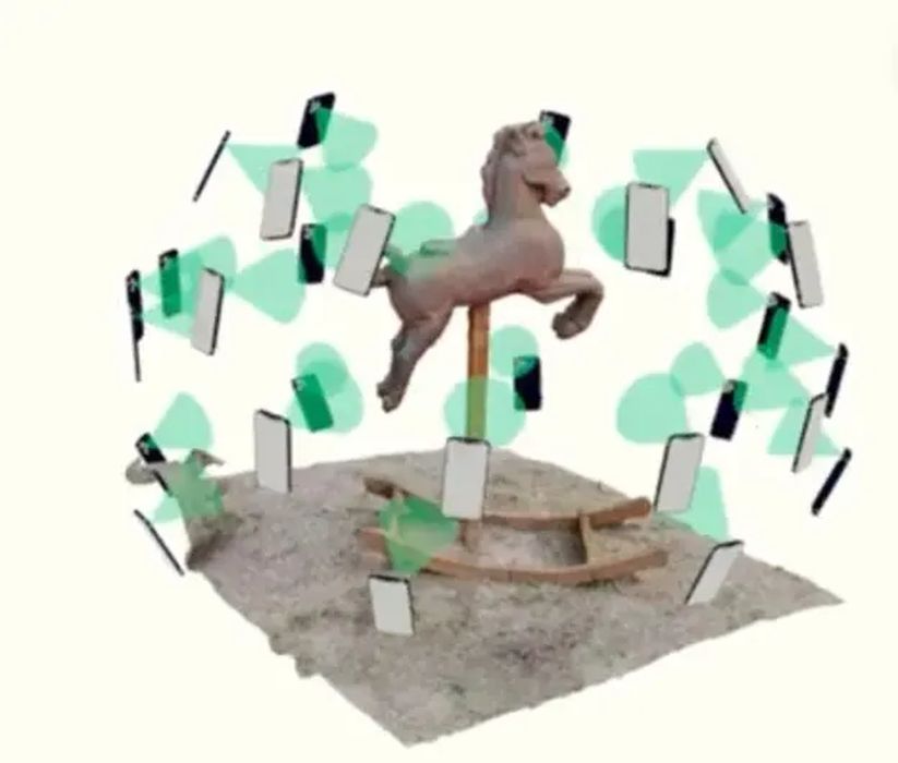
You take a lot of photos of an object, be it a part, product, building, structure, project site, etc., from different angles, going all around it, and input them all into a photogrammetry application which will stitch them all together to make what is essentially a 3D image.
Like the 2D images you took with your camera, the photogrammetry image looks like the object but is not to scale. You need to scale the 3D image up or down so it is dimensionally accurate. For example, if a room is measured at 25 feet, but the photogrammetry image has it at 25 inches, you will need to scale it up 12 times.
From then on, you can use the photogrammetry model for measurement.
What are Alternatives to Photogrammetry?
Photogrammetry is one type of “reality capture” software. Another reality capture method is LiDAR. LiDAR is more accurate. LiDAR generates a point cloud, which is not as user-friendly as a photogrammetry image. Each point could be at mm-level accuracy (depending on the LiDAR sensor), but LiDAR hardware is usually more expensive and LiDAR systems are typically more difficult to use.
What are the Applications of Photogrammetry?
Photogrammetry can make 3D models for reverse engineering, orthomosaic and symbolic maps, GIS software layers or triangulated meshes of building site.
If you have used Google’s Street View, you have used photogrammetry. Google uses specially designed vehicle-mounted cameras that take multiple photos as the vehicle moves down the street. Google’s servers stitch the pictures together to create a 3D image of the roads.
Bridge inspection can be done using cameras mounted on drones flying over and under bridges and with photogrammetry, bridge inspectors can inspect a 3D model of the bridge in the comfort and safety of their office.
In civil engineering, construction, mining, and waste management, photogrammetry models can monitor project progress by analyzing the volumes of cuts, fills, and piles.
Photogrammetry can be used to produce nicely rendered 3D images of historical artifacts for museums. When online, these images can make a museum’s holdings accessible to the public and scholars worldwide.
The Accuracy Issue
Photogrammetry, which creates 3D images of smaller objects, say on a one-foot scale or less than one meter scale, has been slow to catch on, perhaps due to accuracy issues. All CMMs (coordinate measuring machines) use lasers, not photos, for precise measurement.
Read the rest of this story at ENGINEERING.com