

Along with prosthetics, prototypes, jewelry and other increasingly common usage scenarios for 3D printing is one that was discovered years ago but hasn’t seem to grow as much: land models.
The idea of a “land model” is to produce a 3D replica of a landscape that can be used for various purposes including analysis, planning and simply display. It’s much like a 3D map of an area.
You’d think this was straightforward, but actually it’s more involved than just 3D printing a terrain. The problem begins with obtaining a digital 3D model of the required zone, which has to be obtained from reputable geo-sources or generated with 3D topography-scanning equipment.
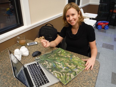
But once obtained, it still isn’t just as simple as printing the 3D model. One business that does this is Filaprint, a very small operation based in the town of Tumbler Ridge, located in the wilds of northern British Columbia, hundreds of kilometers north of Vancouver. Filaprint, owned and operated by Jody Mitchell, produces custom land models for business. Their website explains the benefits:
Filaprint’s unique application for 3D printing has made a breakthrough for land development projects. It brings flat topography maps to life, allowing clients and developers the chance to communicate without the barriers of language or education.
“I know this land, I recognize it with the 3D models. The flat maps were just a bunch of lines and numbers we didn’t understand”
Clean energy producers can showcase Wind Turbine Projects, Dams, Farms, Pipelines or Offshore Drilling Bathymetrics… With a meeting room full of different cultures and backgrounds communication is very powerful and important. Filaprint 3D land models speak to everyone.
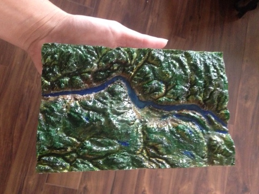
And that’s exactly how it works: a land model is a map, just in 3D.
If you’ve ever attempted to 3D print a landscape yourself, you will immediately note several critical problems:
The 3D elevations are actually pretty flat, unless working on extreme mountainous terrain. This often requires the vertical axis to be exaggerated to provide contrast during examination.
3D prints of terrain data are almost always monotone and devoid of any information other than elevation.
The latter issue is solved by Filaprint by hand painting the prints to transform them from plain plastic into a real, usable 3D land model.
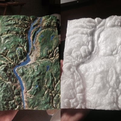
Here you can see the before and after of a specimen.
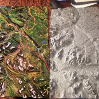
The color textures can add a great deal of visual information to the model, beyond what you would expect to see even if you were somehow capturing photographic images of the landscape. The Filaprint land models can include roads, boundaries, vegetation and more.
It’s a very interesting and unique 3D business that could provide a great deal of value to certain customers.
Via Filaprint