
There’s now at least one new app that takes advantage of Apple’s new LIDAR capability.
A few months ago Apple unexpectedly announced a new iPad Pro model equipped with LIDAR. LIDAR is a range-sensing technology that is often used in high-end equipment for 3D scanning, particularly for landscapes. Seeing it appear in an affordable consumer tablet was quite a shock.
Apple’s intention was to provide additional sensor information to aid their Augmented Reality operations. In other words, when you’re pasting that virtual IKEA couch in your living room view, the couch is positioned more accurately.
However, the presence of a new 3D scanning sensor in an iPad obviously hints that someone would, sooner or later, develop a specialized 3D scanning app to make good use of it.
That now seems to have happened, with startup SiteScape now beta-testing just such an app.
SiteScape is indeed a startup, having registered their domain only three weeks ago! They say:
“Game-changing mapping tech. Map anything, anywhere. Join our free beta to start creating and using scale-accurate 3D maps with SiteScape.”
There’s not much information about the company or app, aside from this short video and a near-empty website:
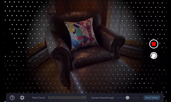
One thing you’ll immediately notice in the video is a view that shows the scanning taking place, and also seen in the image at top. There you’ll see a rather sparse array of LIDAR dots illuminating the surface. This array is really not particularly dense, so it may be a bit confusing as to how a 3D scan could be captured properly.
First, realize that Apple’s purpose here is primarily to capture distance data for their AR system, not to capture detailed 3D scans. The sparse array should be more than adequate for that purpose.
But for capturing a 3D scan remember that it’s not a “single image” process. This array is being swept across the subject, repeatedly. As the dots pass over each square centimeter of the subject, more data is captured. So by putting the array in motion, there are far more data points being collected. That said, it likely results in somewhat lower resolution and the capture may take longer to complete.
The resulting 3D models seem pretty decent, although they appear to be point clouds that will have to be converted into mesh formats to enable 3D printing. That’s easily done with several tools, including the free MeshLab, but there will likely be a lot of 3D model cleanup and tweaking required.
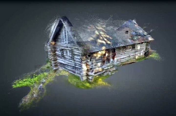
Here’s an example of such a capture, stored on SketchFab. You can actually find a number of SiteScape-captured 3D models on that site.
Unfortunately I am not able to perform any testing of this app, as I don’t happen to have a brand-new iPad Pro with the LIDAR feature. However, if any readers happen to have one, we’d be happy to work with you on doing so.
[UPDATE] It seems there is another LIDAR app example that’s just come out: Scandy, a long-running 3D scanning app. Here’s their video showing how it works: