
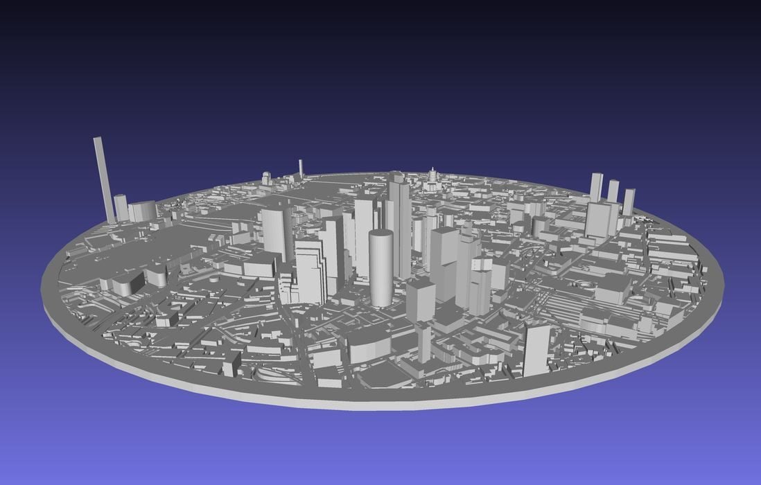
I’ve found a new way to generate cityscapes for 3D printing.
You’ve probably seen these before: a 3D print of your city, including buildings, streets, and parks. They’re quite fascinating as you can look at your city in a different way.
A 3D model of the streets and buildings is obtained, and then printed.
But how and where do you get them? One tool I found some years ago was CADMAPPER. It’s still around, but requires a login to proceed, unlike its initial release, and it seems there are purchases involved as well. Even then, there was a restriction that you could only map one square km tiles at a time.
Now there is a new platform that does more or less the same thing: Map2Model. It’s made by Smoggy3D of Patreon, who normally produces extraordinarily cute 3D models of knitted animals.
Map2Model, a web app, is ridiculously easy to use. It presents a map window, where you scroll around to find the area of interest. Then you define the specific zone for the 3D model. You can define the zone as a rectangle, square, circle, or arbitrary polygon.
Map2Model then uses OpenStreetMap data to develop the 3D model when you hit the “generate mesh” button. You can view the resulting design in a 3D window to verify that it’s what you wanted. Eventually, you download either an 3MF or STL file and print it.
Note that depending on your zoom level, the buildings can be quite small, so you will need a 3D printer with resolution to match. It’s also possible to print several patches in sequence, if you carefully select the start points for each region. You could then mount them adjacent to each other and create a much larger physical map.
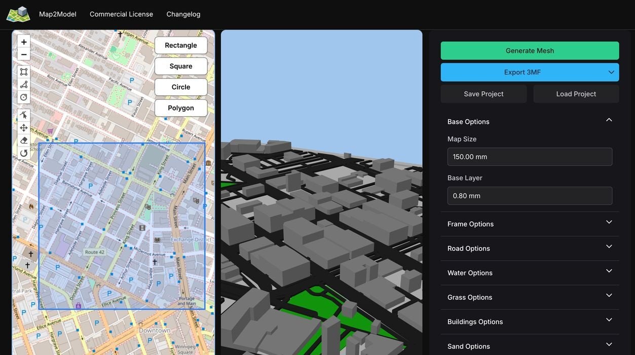
There are quite a few options to modify the generation. You can adjust the height of the roads, or cut out water regions, for example.
The OpenStreetMap data is not bad, but in my experiments there are some quirks. Sometimes the buildings are the wrong geometry, and in one case a tall building was represented by a segment hanging high in the air. In other words, please check out the resulting mesh carefully before printing. You may need to do some tweaks.
While I’ve been talking about printing cities and buildings, I wondered if it is also possible to use Map2Model to print landscapes. I zoomed in on Mount Everest, and this is what I generated:
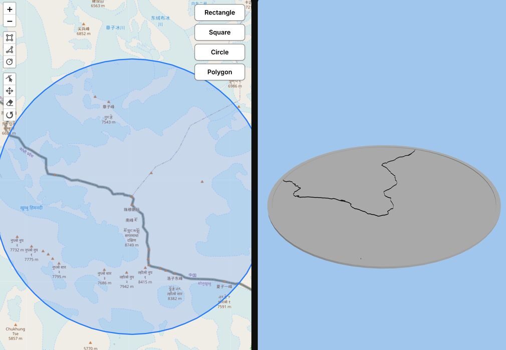
Evidently OpenStreetMap data does not include everything, so you’ll have to discover whether your target exists or not.

I did try a cityscape with known contours, San Francisco. It also rendered perfectly flat, so it seems there is no elevation data available.
Nevertheless, most cities are indeed flat and Map2Model should work reasonably well.
Via Map2Model