
A new approach to airborne 3D scanning has been developed.
3D scanners take many forms, such as handheld, turntable, tripod, and more. But one of the more interesting approaches is done using drones. The idea is to use the high-resolution cameras on a drone to capture a sequence of images of a large subject, such as a building or even a neighbourhood.
These images can then be combined together using photogrammetry to develop a 3D model of the subject. This is essentially the same photogrammetry process as is done on the ground with collections of images, except that the images here are taken by a drone. Sometimes a video is converted into a sequence of still images for this purpose.
However, there are issues.
Researchers in China report that registration issues occur frequently, along with altitude mis-estimations, uncertainty of flight tracks, and other factors that result in poor resolution and missing geometry. This is one reason you might see poor 3D representations of city buildings in Google Earth, for example.
The researchers developed a new technique that overcomes some of these issues.
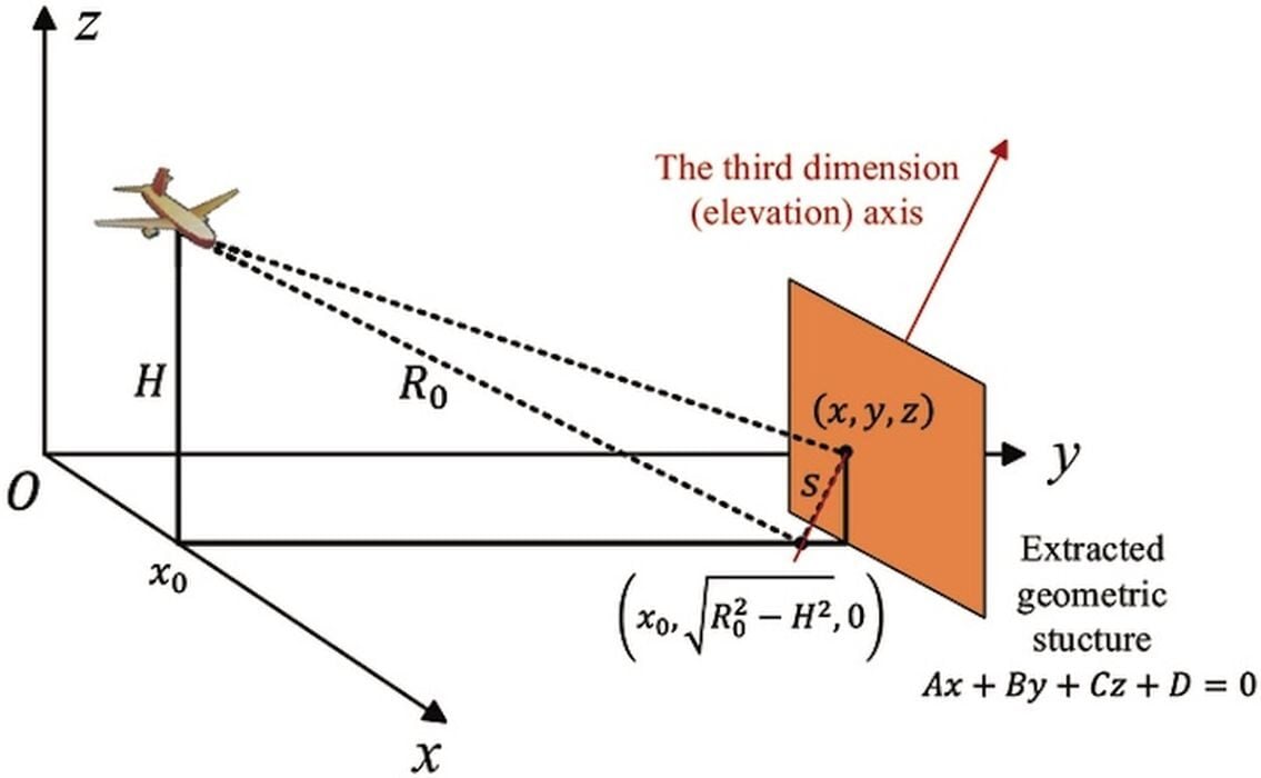
Instead of optical or LIDAR images, the researchers used Tomographic Synthetic Aperture Radar (TomoSar) to capture images. TomoSar is a kind of microwave radar that works in all weather conditions, and even at night when there is no light for optical imaging.
However, TomoSar has typically not been used for this purpose because it has relatively low spatial resolution, and the signals collected are hard to analyze.
That’s where their new framework comes in. They developed “Geometric Semantic Enhanced TomoSAR Reconstruction Algorithm”, which is able to sort out the radar images properly. This is done by integrating prior geometric knowledge that was extracted from the obtained point clouds, and then using a Bayesian estimation to guide 3D reconstruction. This improves accuracy and even the density of the generated 3D models, as up to 80% of the points are retained. That in turn means there is less post-processing required to, say, fill holes or otherwise fix the 3D model.
There are some interesting implications for this new technology. If deployed, it means that high-resolution 3D scans of urban areas can be attempted in any conditions, whereas today it can only be done in certain situations. It could also be used in conjunction with current optical or LIDAR 3D scans to refine the final results.
Via Science