

A new project hopes to provide an ability for educators to create any type of 3D contour maps.
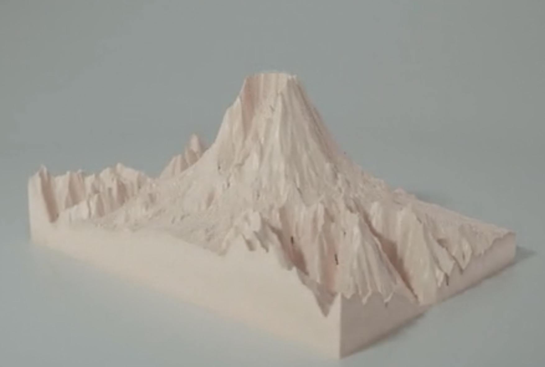
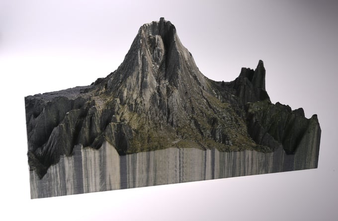
Sightline Maps launched their crowdfunding campaign today. It’s a cloud-based service that provides an ability to select a map section from literally anywhere in the world and produce a 3D model of the selected area.
This 3D model could be inspected online – or 3D printed directly. They appear to offer a download of a STL file that could be printed on almost any 3D printer.
The company apparently combines a typical map interfaces with high resolution GIS data to dynamically generate the maps.
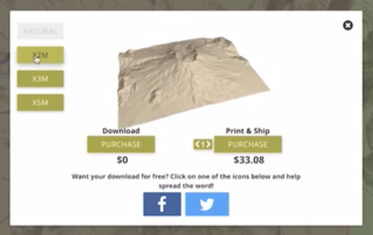
Their business model appears to be a freemium package in which the 3D models are downloadable at no charge, or you can request a professional high-quality 3D print for a fee. I suspect Sightline Maps gathers in a small commission for each print.
The company has beta tested their system with a variety of industries, including very unusual applications such as mountain climbing, where I presume the climbers would 3D print a model of the target mountain to plan out a complex route to the top.
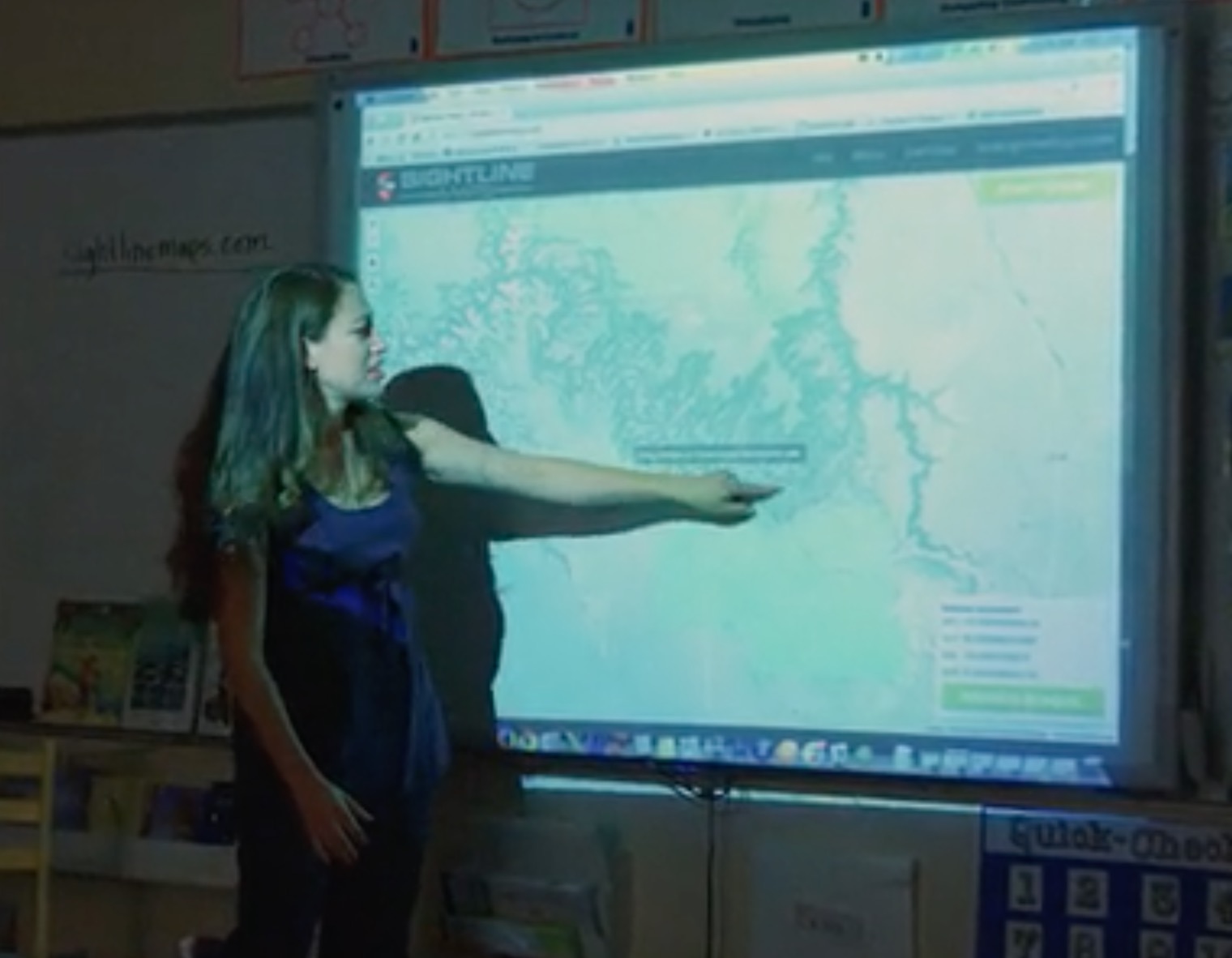
However, the beta testing showed the most promise in the education market, where children were the most frequent users.
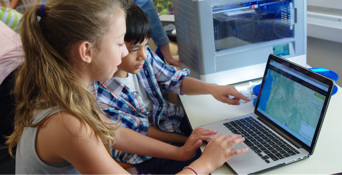
It’s a great idea, as it demonstrates a number of key learning topics to a class, including geography, measurements, on demand manufacturing and certainly 3D visualization.
If the service works, why the need for a Kickstarter? The company explains they wish to add in additional features requested by educators, and in particular the ability to produce full color models based on aerial imaging.
This is interesting, as most schools would not have access to a color 3D printer, and their only alternative would be to request a professional color 3D print from Sightline Maps’ service. I think I understand how they’re going to make their business model work now!
Regardless, this seems like a great service for children. If you’d like to support this project, by all means purchase a single model or subscription from their campaign page.
Via Kickstarter and Sightline Maps